


HarmonyOS鸿蒙Next中简单的路径规划案例分享
HarmonyOS鸿蒙Next中简单的路径规划案例分享
本文大纲
- 项目背景
- 集成准备
- 主要代码
- 成果展示
一、本项目用到的功能点:
地图服务(Map Kit)给您提供一套地图开发调用的SDK,地图数据覆盖超过200个国家和地区,支持数百种语言,方便您轻松地在应用中集成地图相关的功能,全方位提升用户体验。
关键字搜索:通过指定的关键字和可选的地理范围,查询诸如旅游景点、企业和学校之类的地点。
路径规划:是一套以HTTPS形式提供的步行、骑行、驾车路径规划以及行驶距离计算接口,通过JSON格式返回路径查询数据,提供路径规划能力。
二、集成准备
1. AGC账号注册,项目创建
-
注册成为开发者
-
创建应用,添加sha256,开启map/site开关,下载json文件
-
集成Map + Site SDK
- 将“agconnect-services.json”文件拷贝到应用级根目录下
- 在“allprojects > repositories”中配置HMS Core SDK的Maven仓地址。
- 在“buildscript > repositories”中配置HMS Core SDK的Maven仓地址。
- 如果App中添加了“agconnect-services.json”文件则需要在“buildscript > dependencies”中增加agcp配置。
buildscript {
    repositories {
        maven { url 'https://developer.huawei.com/repo/' }
        google()
        jcenter()
    }
    dependencies {
        classpath 'com.android.tools.build:gradle:3.3.2'
        classpath 'com.huawei.agconnect:agcp:1.3.1.300'
    }
}

allprojects {
    repositories {
        maven { url 'https://developer.huawei.com/repo/' }
        google()
        jcenter()
    }
}
- 在“dependencies”中添加如下编译依赖
dependencies {
    implementation 'com.huawei.hms:maps:{version}'
    implementation 'com.huawei.hms:site:{version}'
}
- 在文件头添加配置
apply plugin: 'com.huawei.agconnect'
- 在android中配置签名。将生成签名证书指纹生成的签名文件复制到您工程的app目录下,并在“build.gradle”文件中配置签名。
3. 项目中用到的主要代码及功能
1. 文本搜索
通过实现Site Kit中的textSearch功能实现文本内容搜索并展示出来。
SearchResultListener<TextSearchResponse> resultListener = new SearchResultListener<TextSearchResponse>() {
    @Override
    public void onSearchResult(TextSearchResponse results) {
        List<Site> siteList;
        if (results == null || results.getTotalCount() <= 0 || (siteList = results.getSites()) == null || siteList.size() <= 0) {
            resultTextView.setText("Result is Empty!")
            return;
        }

        mFirstAdapter.refresh(siteList);

        StringBuilder response = new StringBuilder("\n");
        response.append("success\n");
        int count = 1;
        AddressDetail addressDetail;
        Coordinate location;
        Poi poi;
        CoordinateBounds viewport;
        for (Site site : siteList) {
            addressDetail = site.getAddress();
            location = site.getLocation();
            poi = site.getPoi();
            viewport = site.getViewport();
            response.append(String.format(
                "[%s] siteId: '%s', name: %s, formatAddress: %s, country: %s, countryCode: %s, location: %s, poiTypes: %s, viewport is %s \n\n",
                "" + (count++), site.getSiteId(), site.getName(), site.getFormatAddress(),
                (addressDetail == null ? "" : addressDetail.getCountry()),
                (addressDetail == null ? "" : addressDetail.getCountryCode()),
                (location == null ? "" : (location.getLat() + "," + location.getLng())),
                (poi == null ? "" : Arrays.toString(poi.getPoiTypes())),
                (viewport == null ? "" : viewport.getNortheast() + "," + viewport.getSouthwest())));
        }
        resultTextView.setText(response.toString());
        Log.d(TAG, "onTextSearchResult: " + response.toString());
    }

    @Override
    public void onSearchError(SearchStatus status) {
        resultTextView.setText("Error : " + status.getErrorCode() + " " + status.getErrorMessage());
    }
};

// Call the place search API.
searchService.textSearch(request, resultListener);
2. 步行路径规划
通过调用Map Kit 中的API接口实现数据回调并呈现在地图上。点击可获取API文档。
NetworkRequestManager.getWalkingRoutePlanningResult(latLng1, latLng2,
    new NetworkRequestManager.OnNetworkListener() {
        @Override
        public void requestSuccess(String result) {
            generateRoute(result)
        }

        @Override
        public void requestFail(String errorMsg) {
            Message msg = Message.obtain();
            Bundle bundle = new Bundle();
            bundle.putString("errorMsg", errorMsg);
            msg.what = 1;
            msg.setData(bundle);
            mHandler.sendMessage(msg);
        }
    });
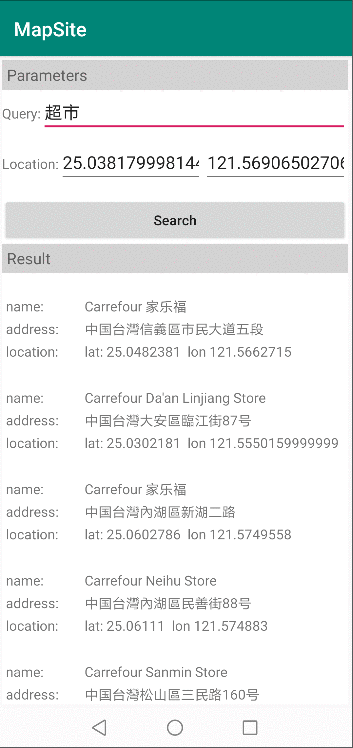
四、项目成果展示
欲了解更多详情,请参阅:
- 华为开发者联盟官网:https://developer.huawei.com/consumer/cn/hms?ha_source=hms1
- 获取开发指导文档:https://developer.huawei.com/consumer/cn/doc/development?ha_source=hms1
- 参与开发者讨论请到Reddit社区:https://www.reddit.com/r/HuaweiDevelopers/
- 下载demo和示例代码请到Github:https://github.com/HMS-Core
- 解决集成问题请到Stack Overflow: https://stackoverflow.com/questions/tagged/huawei-mobile-services?tab=Newest
更多关于HarmonyOS鸿蒙Next中简单的路径规划案例分享的实战教程也可以访问 https://www.itying.com/category-93-b0.html
1 回复

更多关于HarmonyOS鸿蒙Next中简单的路径规划案例分享的实战系列教程也可以访问 https://www.itying.com/category-93-b0.html
在HarmonyOS鸿蒙Next中,路径规划可以通过LocationManager和RoutePlan接口实现。首先,初始化LocationManager获取当前位置,然后使用RoutePlan设置起点和终点,调用calculateRoute方法进行路径计算。计算结果包括路径点、距离和预估时间,开发者可根据需求绘制路径或导航。此功能适用于地图应用、出行导航等场景,提升用户体验。